Before reading any further you should know that if you just need a GPS, then I highly recommend using Gaia GPS instead of the Garmin inReach Explorer+. Gaia makes use of technology you most likely already own (your smartphone), has access all kinds of layers, and just flat out works great. If battery life is a concern, spend a few bucks on an Anker PowerCore (or some iteration of it that fits your weight and recharge needs) and you are set. If you aren't looking for satellite messaging capability as a primary need, then stop reading now and save yourself $400+.
If you are still reading, we will be operating with the understanding that satellite communication is really important and that you would also like to have GPS functionality. I list satellite communication first because that is what this device does best. It also works fine as a GPS, compass and altimeter, but I wouldn't buy it if the satellite communication weren't part of the package.
Let's talk money. Without a sale (which you should be able to find) this will set you back $450 at the time of this writing. On top of that you will need to sign up for one of the subscription plans. Please check out Garmin's website for the details on all the options. I run with the "Safety" plan and signed up for the annual contract, which means I'm shelling out $12/month ($144/year). As far as I can tell, the GPS won't work if you don't sign up for a plan. I don't see that as an issue, because I wouldn't buy it if satellite communication wasn't a top priority.
A year of two of this subscription could buy me some other gear that I'm interested in, so why is it worth it?
- It makes my wife and my friends' wives feel much better. Don't underestimate the power of a happy significant other when it comes to the ease of future microadventures. Whether it is just seeing our progress over the course of a hike or the reassurance that if we were in a jam we could let them know, this purchase is at least 50% about the people that aren't going on the microadventure.
- Having a way to communicate the need for help while out of cell phone range is wise. I have helped to pack out a member of our group that fell on a jagged rock, lacerated his calf (27 stitches worth) and fractured his tibia. If that were me on a solo hike or another group member when we are too far in to bring about a timely evacuation, I would happily shell out way more that $144 to push the SOS button.
- It is also an altimeter, digital compass, and GPS.
- It can also give you weather forecasts based on your location, which is a nice feature on longer adventures or during times of changing weather (welcome to Colorado...).

The inReach Explorer+ provided real-time location updates, weather forecasts, and allowed me to coordinate a pick up time on this solo trip.
While the various subscriptions give you options, I have found the Safety to be more than adequate. I don't see the need for Tracking Points, which are little pings that show when you were somewhere. With unlimited pre-set messages (can only have 3 versions of these), I can ping out my location all day long or at every trail junction for free. When you set up the preset messages you have the option to include your location in the message. I don't know why anyone wouldn't do this. Doing so doesn't cost extra.
The three messages I run with are:
- "All is well. Here are my coordinates..." I send this one out multiple times a day.
- "Arrived at camping spot. Here are my coordinates..."
- "Arrived back at trailhead. Headed home. Here are my coordinates..."
In addition to the unlimited use of the preset messages, you also get 10 custom messages per month as part of the safety plan. Since a huge part of my microadventures is disconnecting, these 10 messages have been about 9 to 10 more than I need each month. If you are into updating the world or chatting up a storm while in the middle of nowhere, then a more expensive plan may be the right one for you. Keep in mind you aren't limited by the number of messages you can send under the Safety plan, you will just be charged $0.50 for each one. If I'm ever in a jam, that will be a non-issue.

Holy Cross Wilderness Area - used the inReach for GPS, weather, and location updates.
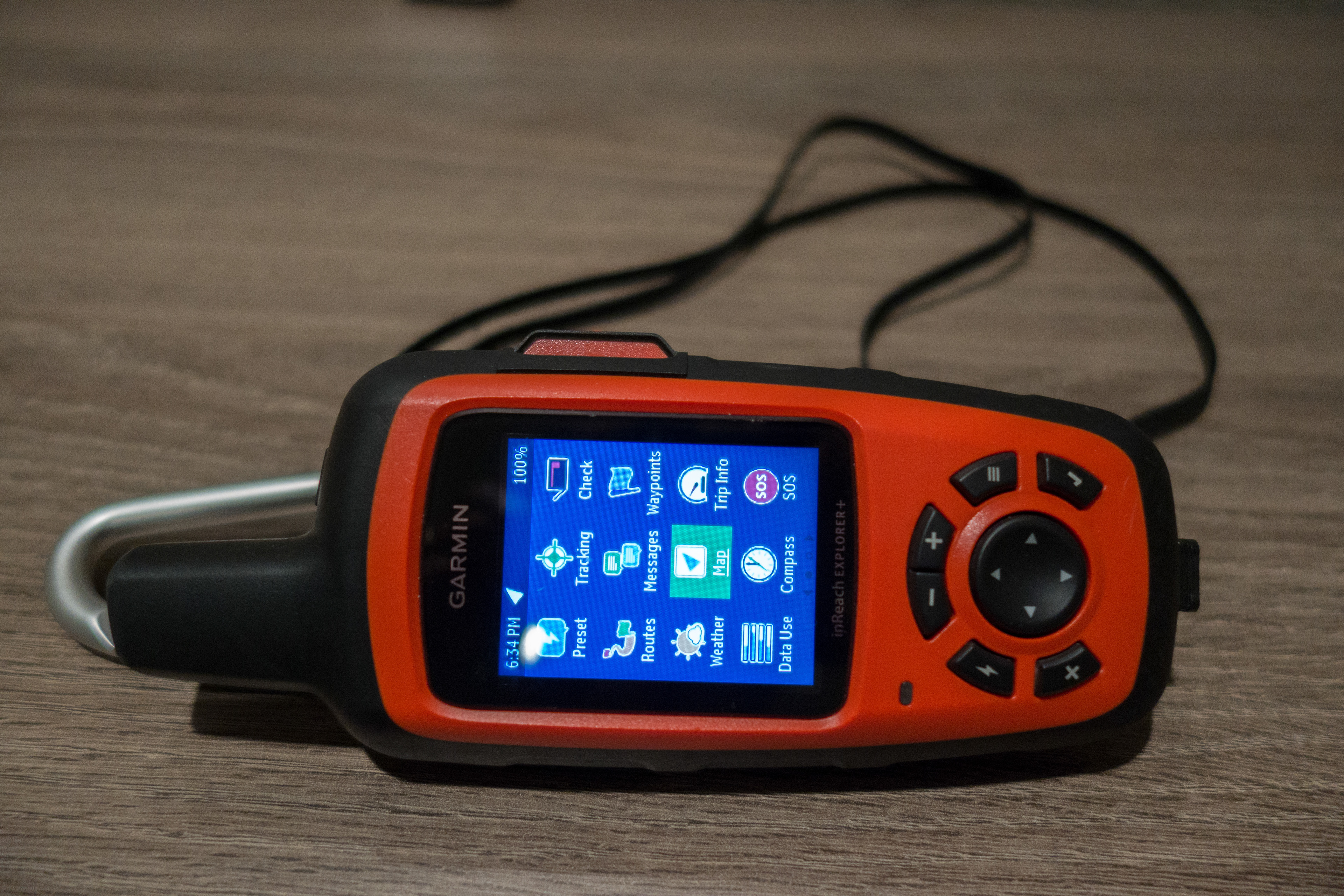
One of my favorite features is the little key with the lightning bolt on it (see first photo in this review). Push it and you have instant access to send off one of your pre-set messages. Overall, the menu system is a little clunky, but works. Rather than give you a detailed step by step, I encourage you to read this very detailed review, which really gets in the weeds.

In good weather, with clear views of the sky the unit pings to let me know the message has gone out within a minute or less. However, tree cover, cloud cover, and narrow canyons can interfere with how long that takes and sometimes the message doesn't go out until I have hiked to a more signal-accessible location. I could see that being a problem if I had a broken leg and moving wasn't an option. So, please understand that this will not get a signal out under any and all situations. That is why I still leave detailed trip information with somebody that isn't coming on the microadventure and provide a set time at which they should call in the calvary.
Battery life has been fine and is affected by how often you set the device to record your position. I haven't used this for more than 3 days in a row (on all day, off at night) yet, but have not had any issues with the battery over that timeframe. It has a sealed, rechargeable battery that you can't swap out. That is certainly a downside, but has not been an issue yet for me.
I have not been impressed with the distance measuring accuracy of the GPS. In my experience it tends to indicate I have traveled about 10% to 15% farther than other GPS devices or map measurements indicate. The built in maps are OK. While not highly detailed, they provide sufficient information since I always print a map via Caltopo for backup and more detailed information.

While I'm not blown away by the Garmin inReach Explorer+, it does provide a generally reliable means of satellite communication in a device that also provides reasonable GPS, altimeter, and digital compass functions. That doesn't sound like high praise, but in my experience this is the best overall device that combines these features.